BIKE
Group Ride Rules 📋BE PREDICTABLE
SAFETY FIRST
ROUTE OVERVIEW
| UPCOMING RIDES
| Bike Coach: Jaffa Prince |
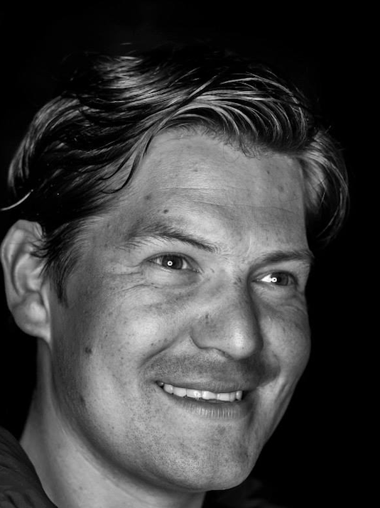 Jaffa Prince has been based in the Bay Area since 2002. Jaffa has competed at elite levels in water polo, triathlon and road cycling. From 2002-2011, Jaffa focused on triathlon, achieving numerous podiums in top tier races in California and in World Championships at various distances. Unfortunately injury forced Jaffa to focus away from running and in 2012, dedicated himself to cycling, quickly earning the Pro 1/2 status, racing for Norcal teams.
⚠️ SAFETY RULES ⚠️
It's important to always prioritize safety when biking, and to be alert at all times. The rule of thumb is to ride predictably. Here are the safety rules that will apply to all of our club rides without exception.
- Always wear a helmet. You will be sent home if you show up to a ride without one.
- Obey traffic laws. This should be very obvious. Not only because it's the law but also because it helps you be predictable to other riders and cars and keeps you and everyone you're riding with safer.
- Do not listen to any audio while on a club group ride outdoors, including music, podcasts, and phone calls. This includes having one earbud in one ear, or having transparency mode on! Even playing music out loud can distract you and make it hard to hear other cyclists, cars, and pedestrians. Hearing can save your life and the lives of those around you.
- Understand signals, and know how to signal. Signaling is actually required by law under the California Vehicular Code. It tells those around you (both cyclists and cars) what you are doing and helps prevent crashes. It is always good practice to use signals, even if you are the last cyclist in a group or biking alone. The 3 major signals you'll see are left, right, and stop. Check out these descriptions of the signals. A quick search will also show you what they look like. We will use other signals as well to communicate slowing/braking, potholes/debris on the road, and oncoming traffic from both the front and back. If you cannot yet signal with your hands, you should be yelling "left turn", "right turn", or "stopping" loudly.
☝️ BEST PRACTICES: Group Rides
Aside from these safety rules, there are also some things to know about group riding dynamics. Each club member has a responsibility to do their best to adhere to these best practices.
- Make it easy for cars to pass you. This means riding in the bike lane when it is there and staying to the right of the lane if there's no bike lane. When you're strung out or have a smaller group, ride single file or at most 2-wide on car-free roads or if the bike lane is wide enough. Bridge crossings, 1 or 2-lane roads, and roads with heavy car traffic are all examples where you should be riding single file. You may claim the lane if there are unsafe road conditions (potholes, debris, etc.), if the road is too narrow for cars to pass in the same lane (<14 ft or 4.3 m), on technical descents, or if you're in a very large peloton. If you do claim the lane, stay to the right as much as it's safe to do so and be aware of passing vehicles.
- Do not congregate in the road. When we regroup, everyone should always stop out of the way of traffic. Do not spill over into oncoming traffic, intersections, or crosswalks and be aware of pedestrians when regrouping on sidewalks.
- If you are in aero, maintain a minimum of 3 bike lengths between you and the rider in front of you. When you're in aero, you don't have access to your brakes and have less control over your bike. This legal drafting distance gives you more time in case you have to react quickly to something ahead of you.
- Protect your front wheel by not overlapping with the rider in front of you. You should either be riding right next to or directly behind another rider. Clipping someone's back wheel is likely to result in you losing control of your front wheel and hitting the pavement. No one wants that.
- Avoid sudden movements that are not accompanied by some kind of signal, such as swerving to avoid roadkill without verbally calling it out or manually signaling.
- Turn your bike lights to solid. Blinking lights can make depth perception difficult for your fellow cyclists and other vehicles behind you, and impede road visibility.
✌️ BEST PRACTICES: Pace Lines
Pace lines require additional handling and awareness since riders are generally closer together and can be reaching higher speeds on average.
- Over-communicate to your fellow riders. You should be calling out any turns both verbally and manually, and any obstructions on the road like cones, branches, glass, etc. You should also be letting everyone know if there is an oncoming car or bike on a narrow road, or a slower cyclist that your group plans to pass.
- NO AERO unless you are leading.
- Do not join unless you are 100% confident in your own and others' abilities.
- Request to join a pace line. Don't be that stranger who just tags along without asking.
✅ ESSENTIALS CHECKLIST
Before you leave the house, go through this checklist so you have everything you need for a successful and fun ride!
Make sure you've done:
- Checked your tires for damage
- Pumped your tires
- Lubed your chain
- Charged your lights/shifters/power pedals
Make sure you have:
- Bike
- Lights, both front and rear
- Spare tube and/or patch kit (to be extra sure a flat doesn't ruin your ride, bring both)
- CO2 cartridge and device and/or hand pump (again, bring both as an insurance policy)
- Tire levers
- Multi-tool
- Emergency cash
- Identification or emergency contact (you can use something like Road ID or put an easily findable sticker on your helmet)
- Appropriate nutrition based on length/elevation gain of the route and weather
- Cellphone
Make sure you're wearing:
- Helmet
- Shoes
- Bike shorts with padding
- Gloves
- Sunglasses
- Sunscreen
- Cold weather: extra layers, booties
- Rain: waterproof clothing
Looking for more cycling content?
Checkout our other pages for:
Questions? Ask the Bike Director, Jaimie at bike@ggtc.org
Golden Gate Triathlon Club is a 501(c)7 non-profit organization. |